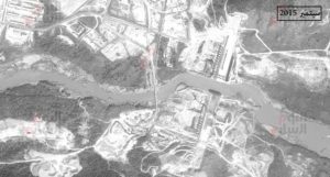
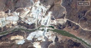
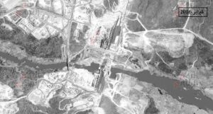
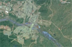
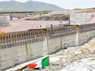
Recent images via satellite unveiled that Ethiopia completed the construction the Renaissance Dam a month ago, according to photos obtained by al-Youm 7 site, an Egyptian privately-run daily newspaper that is close to the military junta, according to Al-Arabi 21.
The site confirmed that the latest satellite images captured for the Ethiopian Renaissance Dam revealed that “Addis Ababa” has completely accomplished the dam construction and the nearby lake.Russian Space Agency consultant in Egypt, and the Chairman of the Egyptian-Russian Foundation for Culture and Science, Hussein el-Shafei said,”The satellite images-which were captured and analyzed by satellites related to Belarus,
Russian Space Agency consultant in Egypt and Chairman of the Egyptian-Russian Foundation for Culture and Science Hussein el-Shafei said,”The satellite images which were captured and analyzed by satellites, related to Belarus, Kazakhstan and other space agencies, revealed that Ethiopia has completely ended the construction of the dam since last June, “as reported by al-Youm 7 site.
Al-Shafie pointed that he “follows the construction of the dam via satellites since the beginning of 2015, and he sends analyzed images to the council of ministers on a regular basis.” He added, “Then, comes the surprise in the last images that were captured by the satellites in June as it revealed the completion of the dam construction as well as the nearby lake.”
He added, “The images revealed that the storage capacity of the water reservoir-located behind the dam to store water to generate electricity- exceeded 90 billion cubic meters, not 70 billion cubic meters as it has been reported.”
The Russian space agency counselor said, “The dam has four gates including water turbines to generate electricity.”
He also added, “We worked for more than a year and a half on the dam, and we gave the government for free images from our private sources that it couldn’t acquire on its own, but there has been no response. We do not know where these images go”
He explained that the satellite “Egypt Sat” remained featuring images of the dam until February 2015 till they lost contact with the satellite, and accordingly, the government resorted to American Satellites to obtain these images.”
He noted that “the satellite images have two forms, either to be taken as a raw material to be analyzed by the state, or the state obtains ready-analyzed images instead.”
He also said, “If you take an analyzed image, its reliability lies in the responsibility of those who analyze it, but Egypt has obtained the analyzed images from America.”
He continued, “There are doubts related to the accuracy of the images obtained from the American satellites, as America wasn’t honest in transferring the Dam images to Egypt, and it misled Cairo several times,” adding that throughout history, there were similar situations.